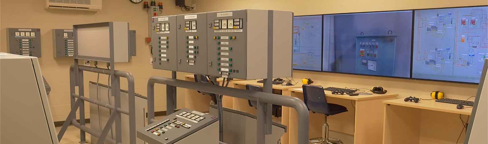
Research at CMTR
The Centre for Marine Training and Research (CMTR) possesses one of very few modelling workstations in North America that is capable of creating any area or any ship for installation on the NT Pro Simulator.
Marine innovation through computer simulation
Today’s simulation fidelity is such that a class of vessel or an individual vessel’s maneuvering characteristics can be modeled into a precise 3D mathematical model.
The new virtual physics engine contained in the NT Pro 5.35 allows for unprecedented interaction and modelling of ice, wind, waves, various bottom characteristics or objects such as bridges, cranes and barges.
Using these technologies, we have the capacity to conduct comprehensive research and analysis. Two main categories of our research include vessel modelling and area modelling.
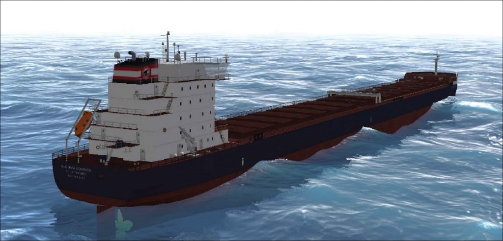
Vessel modelling
Our most recent vessel modelling project was the Algoma Equinox Class in 2015. Design of our models is achieved using AutoCAD and 3Ds Max. Drawing on engineering data and sea trial reports, the vessel models can be optimized for rendering in the simulators to produce the highest possible accuracy and fidelity in the industry.
The highly accurate virtual model of the Algoma Equinox Class vessel is designed for the NT-Pro 5000 navigational simulator at Georgian College. Fidelity of the virtual vessel’s dynamic behaviour and maneuvering characteristics were the primary goals of the project. This model would allow vessel-specific training of bridge personnel in navigation and route planning, ECDIS, SEN, ARPA, collision avoidance, BRM, team management and team building, emergency ship-handling, MOB and SAR operations, close quarters and port maneuvers, anchor handling, docking, lock operations and pilotage training.
Applications of these designing capabilities include:
- vessel design
- vessel refit and optimization
- vessel testing and validation
- experimental vessels
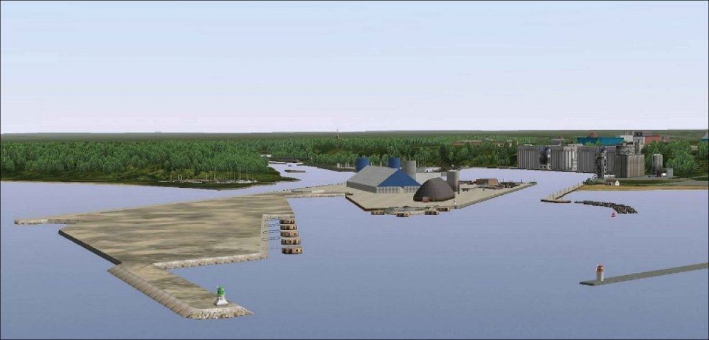
Area modelling
The CMTR can create any harbour, port facility or waterway in the world. This is achieved at the highest technical level available in a simulation. Area development can be used for generalized area familiarization, specific advanced or hazardous navigation, emergency ship-handling, and route planning.
Our latest port and area modelling project was the Goderich Port Re-Design in 2011. This included working with high-resolution bathymetry, SRTM and terrestrial surveyed data. The CMTR worked closely with municipal and engineering consultants to produce simulation studies of vessel traffic and maneuvering in several proposed harbour designs.
Applications of our port and area modelling capabilities include:
- port development
- port operations and transportation logistics
- vessel traffic and maneuvering optimization
- current effects
- high-resolution bathymetry
Other marine research projects
The CMTR has taken on a number of research projects both for industry and internally. These projects range from government contracts to academic endeavours. The following highlights the major achievements of the CMTR:
Hydrodynamics, Tides and Current Profile Research
The CMTR possesses the most accurate contiguous hydrodynamic representation in a navigational simulator of the St. Lawrence Seaway.
Sterling Fuel Facility Study – Detroit River (2009)
The objectives of this study were to determine if a full-sized bulk carrier could maneuver into and use the abandoned slip north of Sterling Fuel Dock, and whether turning dolphins could assist in countering the strong currents at the mouth of the slip. The existing dock facility and slip were created in highly detailed 3D AutoCAD. This included bathymetry and pertinent navigational landmarks which were then installed into the NT Pro 4.62 navigational simulator. Specifically configured ship models representing the company’s vessels were then used in a series of trial exercises to determine the viability of the facility for commercial shipping.
Pelee Passage and Detroit River Augmentation (2012-13)
The area models of the Pelee Passage and Detroit River were augmented by the CMTR, and the results highly exceeded the original 3D areas originally supplied by Transas. The upgrade added all bathymetry in all areas. Significant navigational objects such as the South East Shoal Light and Pelee Passage Light were also created.
Welland Canal (2013-14)
One extremely hazardous element on the Great Lakes is the timing and successful passage under or through bridges. In all of the navigational areas supplied by the manufacturer, no bridges that moved in real life were capable of moving in simulation. The CMTR was able to create these moving hazards in the Welland Canal by the end of 2014. This adds an extra element of reality and navigational difficulty to the training of our mariners.
Owen Sound Transportation Company Vessel Model (2016-17)
This project will be broken into two distinct tasks. The first task is to develop a precise virtual model of the new 399-passenger ferry vessel intended to replace the existing vessel, M.V. Pelee Islander. The vessel will service the route between Pelee Island and the mainland harbours at Leamington and/or Kingsville. The fidelity of the virtual vessel’s dynamic behaviour and maneuvering characteristics will be the primary goal.
Contact the Centre for Marine Training and Research
For more information, contact us today!
Phone: 519.376.0840, option 6
Toll-free: 1.866.468.3225
Not sure where to start?
- General questions about marine programs and courses: Contact us today
- Registration questions: Email the registration team
- Commercial training questions: Contact the commercial training team